
Ouabache Land Conservancy Partners with Sam Shine Foundation to Advance Migration Science
A nondescript tower at Atherton Island will soon be listening to the sky.
Not for storms.
Not for aircraft.
But for wings.
Allen Pursell, Director of Forest Programs for the Sam Shine Foundation, described the growing partnership between the foundation and Ouabache Land Conservancy to install a Motus Wildlife Tracking System tower on Atherton Island. The project places West Central Indiana into a hemisphere-wide scientific network studying migratory birds, bats, and other wildlife.
“It’s going to make a real contribution to what we know about migration,” Pursell explained.
How the Partnership Began
The collaboration started with a conversation at a Wabash Valley Audubon annual meeting. Pursell had been presenting on Forestry for the Birds, a conservation program he helped develop in Indiana. Seated nearby was Marty Jones, representing Ouabache Land Conservancy. Birds, as they often do, became the bridge. Marty told Allen about the Ouabache Land Conservancy. “We talked about our shared interest in birds and conservation, and eventually the idea of building a Motus station came up,” Pursell recalled.
Soon after, discussions continued, including a visit to southern Indiana to explore what a partnership might look like. The pieces aligned: Ouabache Land Conservancy would host and maintain a Motus station at Atherton Island, and the Sam Shine Foundation would provide funding and technical guidance to bring it to life.
A Foundation Dedicated Solely to Conservation
The Sam Shine Foundation is unique in Indiana’s philanthropic landscape. Founded by the late Sam Shine, a New Albany industrialist who built a successful company manufacturing electronic connectors, the foundation is devoted exclusively to conservation.
“We don’t fund education, community projects, or the arts. We are strictly dedicated to conservation,” Pursell explained. Shine, a lifelong conservationist, established the foundation before his passing just prior to the COVID-19 pandemic, ensuring his resources would permanently support land, wildlife, and ecological stewardship. That focused mission made Ouabache Land Conservancy a natural partner.
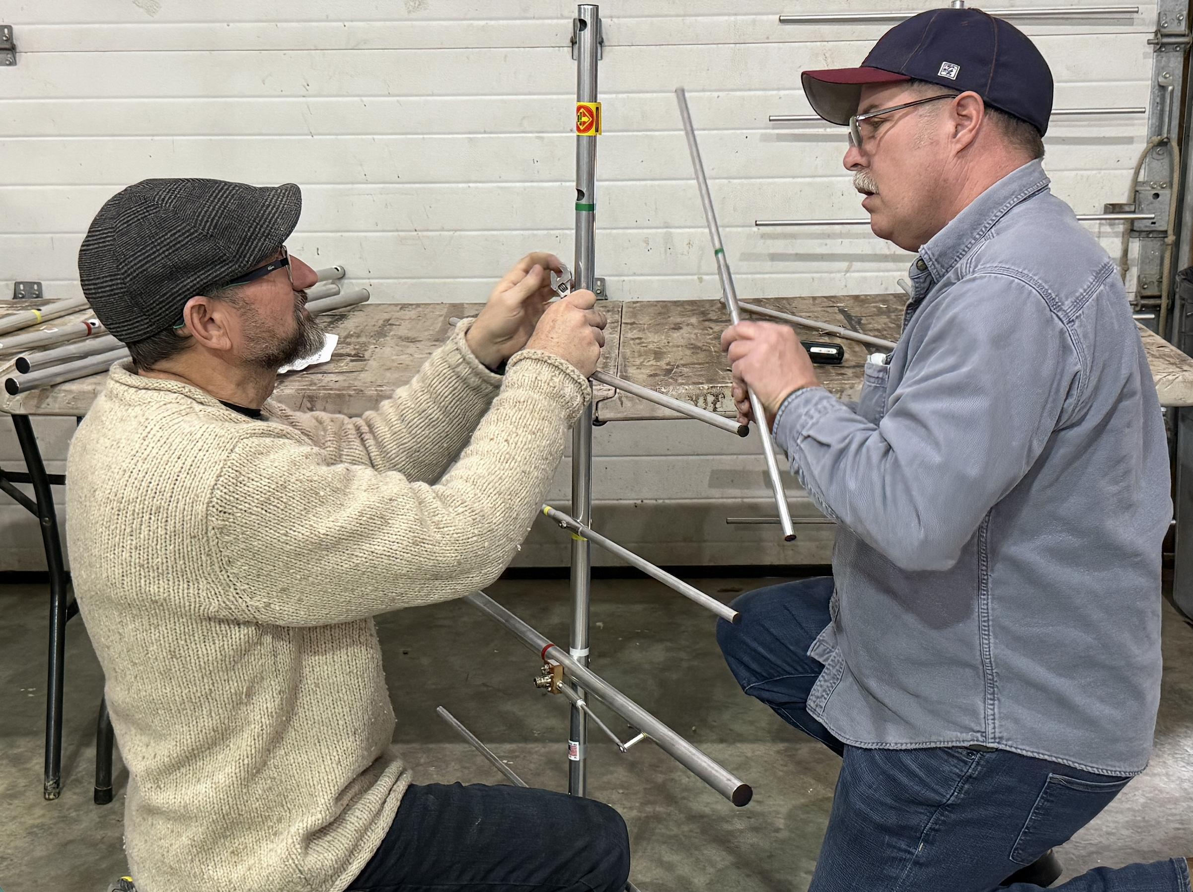
What Is a Motus Tower?
The Motus Wildlife Tracking System, created by Birds Canada, is a collaborative international network of automated radio telemetry stations. These towers function as passive listening devices.
Each station is equipped with antennas that detect tiny radio transmitters placed on birds and bats. When a tagged animal flies within approximately five to seven miles of the tower, the station records its unique signal. The data is uploaded daily through cellular service to Birds Canada, where it is processed and added to a massive shared database.
From there, scientists can map migration routes across states, countries, and even continents.
“If a bird was detected at Atherton Island Natural Area and also detected at stations before or after that, you can see its migration route. All of that information goes into research projects trying to answer major questions about migration,” Pursell explained.
Questions Science Is Still Trying to Answer
Despite centuries of bird study, migration still holds mysteries.
Researchers are currently using Motus data to explore questions such as:
Do thrushes from New England winter in the same parts of Central America as thrushes from the Midwest?
Do birds take different routes in spring versus fall?
How many survive the journey?
Where are the most critical stopover sites that require conservation protection?
“Before this technology existed, we really couldn’t answer those questions. Now we can begin to,” Pursell said.
Why Atherton Island Natural Area Matters
Ouabache Land Conservancy selected Atherton Island as the site for its Motus station. Strategically located along the Wabash River, the property strengthens what Pursell describes as a growing “fence” of detection stations across Indiana. To effectively track migration statewide, stations must be close enough together that birds cannot pass through undetected. Currently, there are very few along the Wabash River corridor.
“There’s one down where the Wabash meets the Ohio, and one in West Lafayette owned by Purdue University, which sits within the Wabash River corridor. This will be only the third one along the Wabash corridor,” Pursell said. The river itself functions as a natural migratory pathway. Adding a station in West Central Indiana increases the likelihood that tagged wildlife traveling the corridor will be recorded.
Towers and Tags: A Two-Part System
The Motus system only works when two things happen simultaneously: stations must be built and maintained, and wildlife must be tagged.
“Stations don’t make any difference if people aren’t putting tags on birds, and tagging birds doesn’t matter if there aren’t stations to hear them,” Pursell explained.
Tagging requires federal permits through the U.S. Geological Survey’s Bird Banding Laboratory and must be conducted under the supervision of licensed master banders. While Ouabache Land Conservancy’s immediate role focuses on hosting the tower, participation in tagging could be explored in the future. For now, the priority is to get the station operational and contribute to the broader network.
A Personal Connection
Though Pursell now lives in southern Indiana, he grew up in Putnam County, within Ouabache Land Conservancy’s service region. “I grew up in that territory, so what the organization is doing is special to me,” Pursell added. He is also a member of the conservancy and praised its steady expansion of conservation work across West Central Indiana. “It’s a good land trust. We’re happy to be partnering with them,” Pursell added.
Listening Toward the Future
Once operational, the Atherton Island Natural Area Motus station will quietly scan the skies day and night, contributing data to one of the most ambitious wildlife-tracking collaborations in North America. For Ouabache Land Conservancy, the project represents more than a tower. It signals a new layer of scientific engagement in the Wabash Valley, strengthening both regional conservation efforts and international research. And this may only be the beginning. “Who knows. Maybe we’ll do another one someday,” Pursell added.
For now, Atherton Island prepares to listen. And somewhere above the Wabash River, a warbler, thrush, or bat may soon cross its invisible boundary, its signal captured, its journey mapped, and its story added to the unfolding science of migration.
The Motus Tower is slated to be completed at the Atherton Island Natural Area in March.